Country Size Comparison Game puts your mental atlas to an honest planetary test by stripping away five centuries of flat-map distortion. Every round places a measured 3D topographic Reference territory on the left—with its verified area in square kilometers or square miles—and challenges you to resize a second 3D territory on the right until their painted land areas match true spherical proportions.
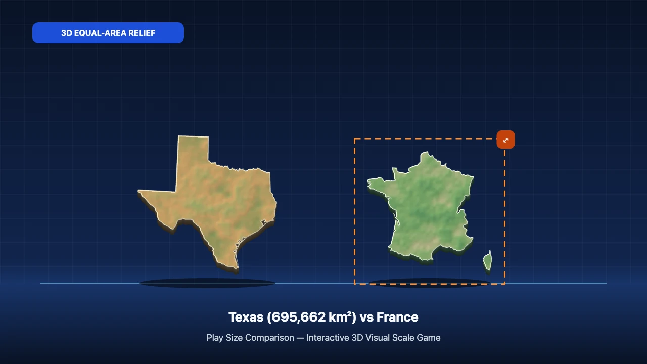
Classroom wall maps and web slippy tiles rely on cylindrical Mercator math designed for compass navigation, not area comparison. High-latitude territories like Greenland, Iceland, Norway, Sweden, Finland, the United Kingdom, and Alaska stretch dramatically toward the poles, while equatorial nations across Africa, South America, and Southeast Asia look compressed. Playing through 84 real 3D relief territories (4,784 valid pairings) in Country Size Comparison Game permanently recalibrates how you see the globe.
Four Scale Tiers Inside Our 84-Territory 3D Atlas
Unlike geography quizzes restricted to giant nations, our atlas spans seven orders of magnitude—connecting walkable city landmarks all the way to continental giants:
- Urban Enclaves & Microstates (0.49 km² to 2,586 km²): Step smoothly from Vatican City (0.49 km²) and Monaco (2.08 km²) to NYC's Central Park (3.41 km²), Manhattan Island (59.1 km²), Washington, D.C. (177 km²), Malta (316 km²), Singapore (734 km²), Hong Kong (1,114 km²), and Luxembourg (2,586 km²).
- Islands, Peninsulas & Compact States (4,001 km² to 110,000 km²): Compare Rhode Island (4,001 km²), Puerto Rico (9,104 km²), Cyprus (9,251 km²), Jamaica (10,991 km²), Qatar (11,581 km²), Hawaii (28,313 km²), Taiwan (36,197 km²), Switzerland (41,285 km²), Netherlands (41,543 km²), Sri Lanka (65,610 km²), Ireland (70,273 km²), Austria (83,879 km²), South Korea (100,410 km²), Iceland (103,000 km²), and Cuba (109,884 km²).
- US States vs. Regional Powers (131,957 km² to 783,562 km²): Test surprising near-twins including Greece (131,957 km²) vs. New York State (141,297 km²), United Kingdom (242,495 km²) vs. Michigan (250,487 km²) and Wyoming (253,335 km²), New Zealand (268,021 km²) vs. Colorado (269,601 km²), Italy (301,340 km²) vs. Philippines (300,000 km²) and Arizona (295,234 km²), Germany (357,588 km²) and Japan (377,975 km²) vs. Montana (380,831 km²), Sweden (450,295 km²) vs. Morocco (446,550 km²), and Texas (695,662 km²) vs. Continental Chile (756,102 km²) and Turkey (783,562 km²).
- Continental & Sub-Continental Giants (1.00M km² to 9.98M km²): Calibrate Egypt (1.00M km²), Colombia (1.14M km²), South Africa (1.22M km²), Peru (1.29M km²), Mongolia (1.56M km²), Iran (1.65M km²), Alaska (1.72M km²), Indonesia (1.90M km²), Mexico (1.96M km²), Saudi Arabia (2.15M km²), Greenland (2.17M km²), DR Congo (2.34M km²), Algeria (2.38M km²), Kazakhstan (2.72M km²), Argentina (2.78M km²), India (3.29M km²), Australia (7.69M km²), Brazil (8.52M km²), China (9.60M km²), and Canada (9.98M km²).
Classic Geographic Surprises Verified by Area Data
| Reference Landmass | Verified Area | Target Landmass | Verified Area | True Equal-Area Reality |
|---|---|---|---|---|
| Greenland | 2,166,086 km² | DR Congo | 2,344,858 km² | DR Congo is 8.3% larger despite looking tiny on wall maps |
| Greenland | 2,166,086 km² | Saudi Arabia | 2,149,690 km² | Virtually identical footprint (within 0.8%) |
| Sweden | 450,295 km² | California (US State) | 423,970 km² | Sweden is only 6.2% larger than California |
| United Arab Emirates | 83,600 km² | Austria | 83,879 km² | Desert & alpine area twins (within 0.33%!) |
| Puerto Rico | 9,104 km² | Cyprus | 9,251 km² | Caribbean & Mediterranean island twins (within 1.6%) |
| Iceland | 103,000 km² | South Korea | 100,410 km² | Nearly identical area, yet South Korea holds 130× the people |
Equal-Area Projection & Pixel Fill-Ratio Math
Two mathematical safeguards ensure what your eye sees on our 3D stage matches physical reality:
- Centered Lambert Azimuthal Equal-Area (
LAEA) Geometry: Every polygon is projected directly from Natural Earth 1:50m and US Census 1:10m coordinates around that territory's own centroid, eliminating polar latitudinal stretch and shaded with authentic biome elevation colors. - Square-Root Linear Scaling + Landmass Density Compensation: Because surface area scales with width × height, a territory covering 4.0× the km² scales linearly by
√4.0 = 2.0×. In addition, our renderer measures exact top-surface landmass pixels (fillRatio, excluding 3D cliff walls and surrounding ocean inside archipelagos) so ribbon-shaped Chile, Vietnam, Norway, and island chains like Indonesia and Hawaii display true painted land area. - Instant Metric & US Customary Area Units: Click Metric / US Units in the top bar during any round to switch territory readouts between square kilometers (
km²), square miles (sq mi), and acres (handy for urban benchmarks like Vatican City at 121 acres and NYC Central Park at 843 acres), while the floor ruler updates its equivalent square-side ticks automatically.
For a deeper cartographic dive, read 10 Mercator Map Myths Busted, test wildlife proportions in Animal Size Comparison Game, run mixed worlds in Size Comparison Game Unlimited, or play today's Size Comparison Game Daily 5.
Be the first calibrator to post today's score or suggest a new comparison object.